[I wrote this on Tuesday but the wifi was pants]
On a shelf, in the house we’re staying at in Ireland, is a book called ‘I Never Knew That About The Irish’ by Christopher Winn. Millan, my nephew who flew over with his mum for a long weekend, dug it out from beneath the assorted Lee Childs and Agatha Christies and read out some of the parts pertaining to County Kerry.
This county contains the most westerly points in Europe, and Dingle, where I started and finished my marathon, is the most westerly town. Driving to Dingle from Cloghane (pronounced ‘Clohaan’) we have taken the Conor Pass, which, according to this book, is the highest road in Ireland.
That road was talked about by Padraig on the first night we arrived with hallowed reverence. He warned us that occasionally the visibility got so bad that tourists have been known to abandon their cars up there and walk, shell-shocked, down one side of the mountain or the other. He then appended his description (in a very American accent) with a nonchalant ‘but we locals do it all the time of course’.
We met Padraig again at the bar when we went down to O’Connors last night for some food. Padraig is retired and ‘comes from’ Ireland originally but lived in the US. The quotes are because I haven’t figured out whether he himself was born here, or whether it is an Americanism for a predecessor coming from Ireland. There seems to be an astonishing number of American accents here. I think I’ve personally spoken to more people from the US than I have Irish people.
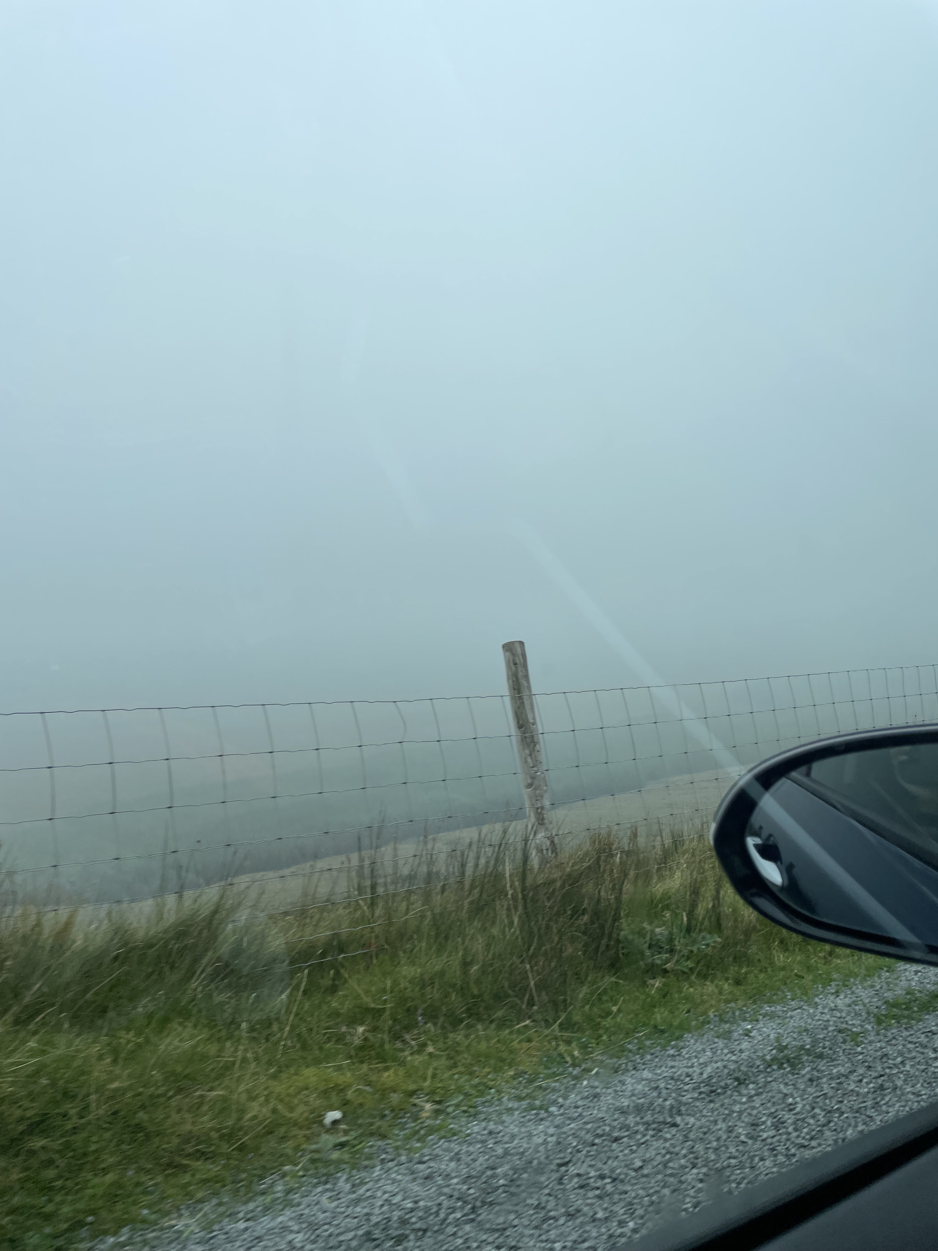
The first time I went to drive on Conor Pass from Cloghane to Dingle, I was trepidatious after those warnings. Because it is a mountain road, the views can either be precipitous or non-existent, as the clouds often come down around you. For me the clouds came, and it took me a few moments to find the rarely used fog-light controls. Not so much for my view, which reached barely five yards ahead whatever I did, but for oncoming traffic, that may want to know about a car coming on the windy single lane road at the top. Pin pricks of light were the first things I could see in the thick white mist, so I think it helped.
I have only had to reverse once into a passing area on this road, and the narrow single-lane section doesn’t last long, albeit it comes on the bendiest bits of the road. Most of it is made up of two lanes, or at least much wider sections. And it means that it takes twenty minutes to get to and from Dingle rather than over an hour by way of some circuitous route. Today, for the first time, I managed to see the expansive views as my sister Hersha drove, and the clouds, ironically, for a morning that had been blowing a hooley, had departed from the tops.
The road is cut into the ridge of the Brandon range of mountains, the highest of which is Mount Brandon. Padraig did talk of this place too, telling us that two people had ‘passed’ on it this year. Micheal, his friend and pub’s proprietor interjected here. ‘Only one has died, the other is still missing.’ He then said something about the person’s rucksack appearing in a very unusual place and that perhaps he wanted to ‘disappear’.
My plan originally, was to do the walk with my sisters, but having read that the ten-kilometre walk would need at least five hours because of the elevation, I let them carry on. My marathon sore legs would not contemplate another huge effort in the same weekend.
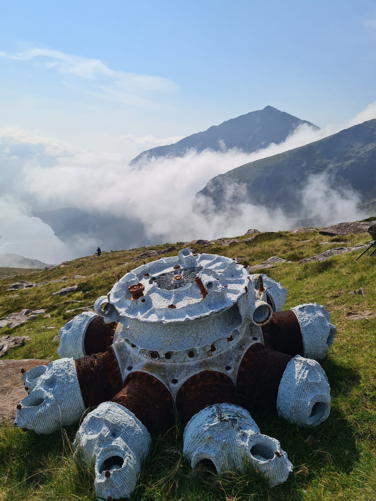
One piece of sound advice that Padraig did give was that when the clouds came over you rapidly, and quite often moved away just as rapidly. He suggested staying put and waiting for them to move, as the visibility could become very poor. As it happened, they picked the right day and time to do the hike, managing to see the grotto, the airplane engine (part of Micheal’s story from the first night), and the cross of Saint Brendan on the summit in beautiful sunshine before encountering the clouds as they got close to the bottom. I am a bit jealous, as their pictures looked amazing, but I’m so glad they had the weather for those stunning views.


There are a lot of Brendans and Brandons in this neck of the woods. Our house, Brandon Point Cottage, is owned by a Brendan, for example. Plus, there is a Brandon Point as well as a Brandon Pier near us. A peak or two alongside Mount Brandon, in the Brandon Group range, there is a Brandon Peak. It feels like a decided lack of imagination.
Saint Brendan, known as Brendan the Navigator, apparently spent forty days and nights atop Mount Brandon, in preparation for his seven-year voyage to find the ‘Isles of the Blessed’. En route, he was beset by demons and monsters, and at one point set up camp on an island, only to find out that it was a whale. He eventually did find his way to the Isles and returned, in his little rowing boat (currach) to tell the tale. Rumour has it that he was the first European to land in the Americas, nearly a thousand years before Columbus. Perhaps the first American to ‘come from’ Ireland.

If St Brendan fought demons and monsters, camped on a whale and made it to the States and back, you’d think he could sort out the internet reception.
Maybe it’s my penance for not getting up to his cross, but slogging around Slea Head instead!